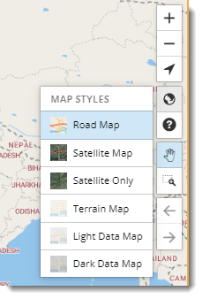
How do I choose a different ContentTools map style?
Yes, there are six different types of map styles available. They are Road Map, Satellite Map, Satellite Only, Terrain Map, Light Data Map, Dark Data Map.
To change Map Styles, click on the Globe icon in the Map control bar on the right side of the ContentTools screen. The default map style is Road Map.