How do I route around roads closed by severe weather?
PC*Miler Web’s traffic feature can help you identify in real-time where roads are closed due to damage from hurricanes or other severe weather. To turn on this feature:
-
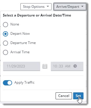
Before entering the stops on your route, select the Arrival/Depart drop-down, and check the slider next to Apply Traffic.
-
Select Depart Now, and select Set to finish.
-
As PC*Miler calculates the route, it will look for any current road closures and route around them, unless one of your stops is located on a closed road.
View road closures on the map
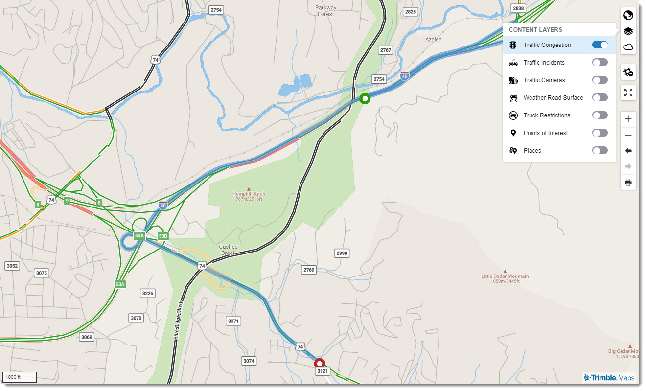
You can also view closures on the PC*Miler map.
-
In the map controls on the right-hand side of the screen, select Content Layers and toggle on the switch for Traffic Congestion.
-
Closed roads have a black overlay, as in this October 2024 example near Asheville, NC, after Hurricane Helene. (Select image to enlarge)
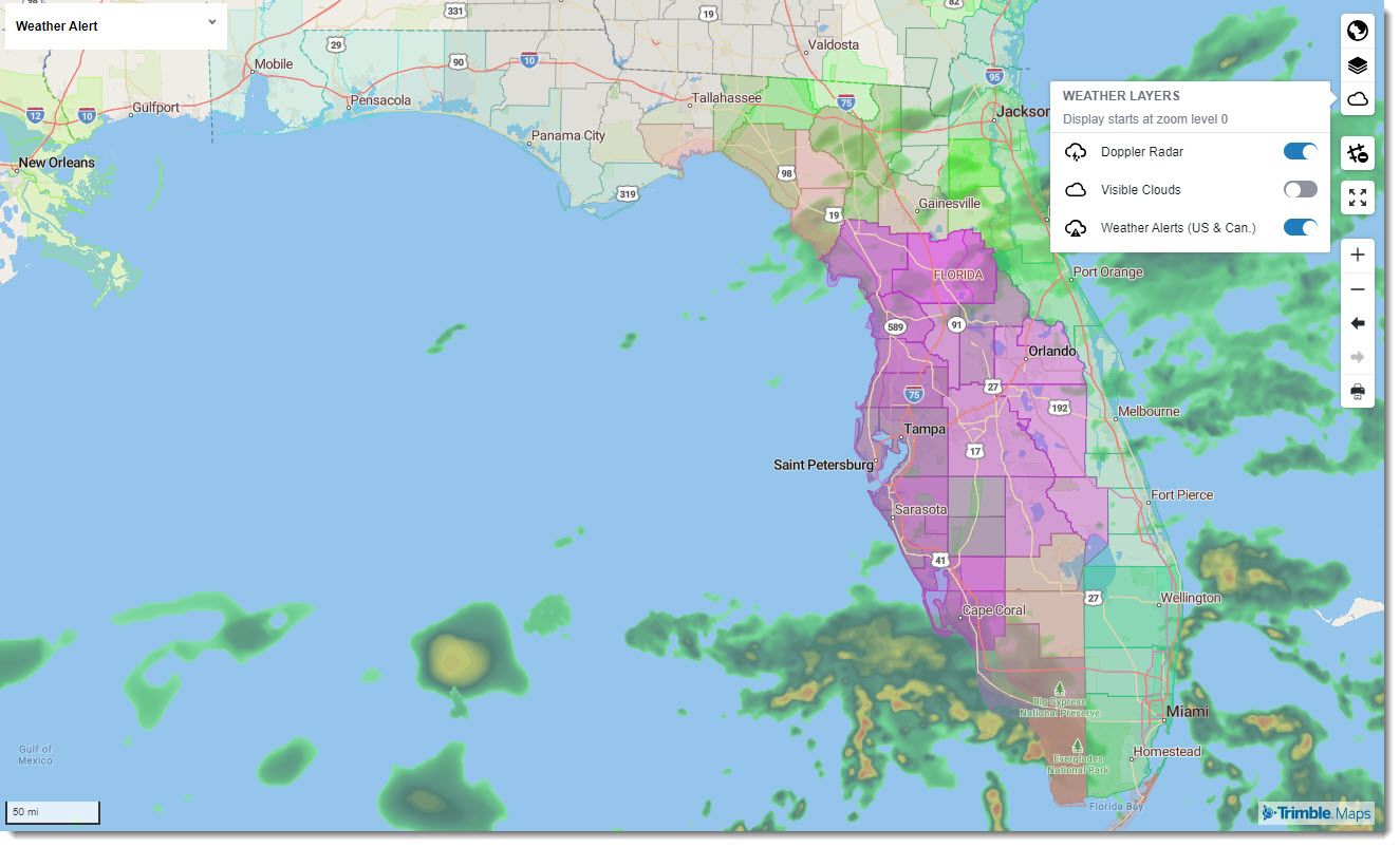
Weather
Current weather conditions can also help you better plan routes during a storm. Learn more about setting weather-related map layers. (Select image to enlarge)