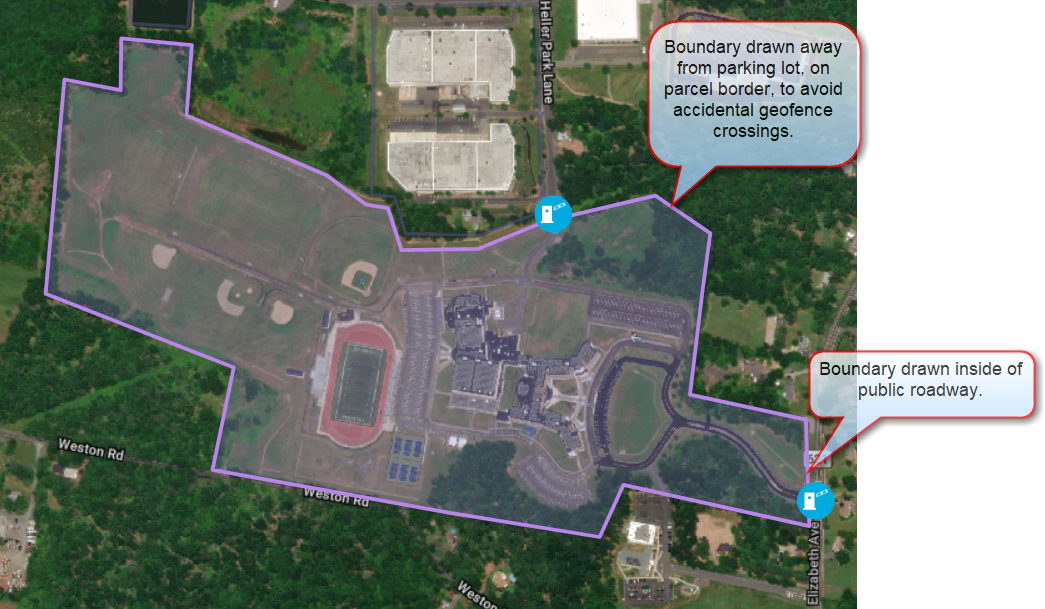
Where should I draw the perimeter when creating a Site?
When drawing Site boundaries, use a satellite map style and look for fences or tree lines, or use the parcel boundaries. By following parcel lines, you create Sites that have a buffer between parking areas and the Site boundary. That buffer is important because a Site can be used as a geofence to determine when a vehicle enters or leaves the property. A vehicle parked too close to the boundary might register as crossing the geofence.
Other important things to remember when drawing a Site:
-
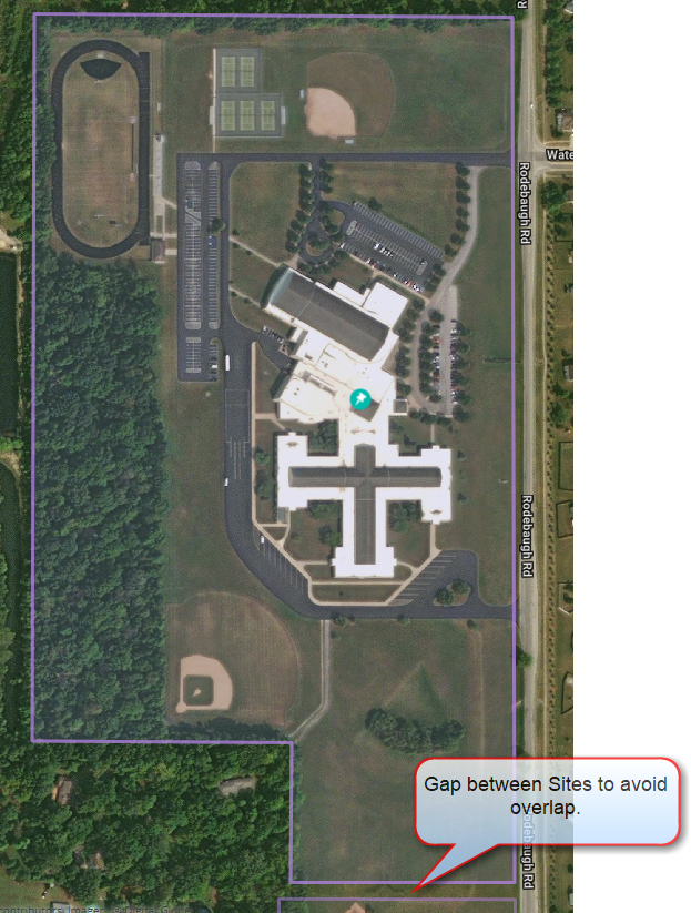
Polygons cannot overlap if you have multiple Sites near each other.
-
Polygons should not overlap road links not included in that facility. (These are usually public roads.)
-
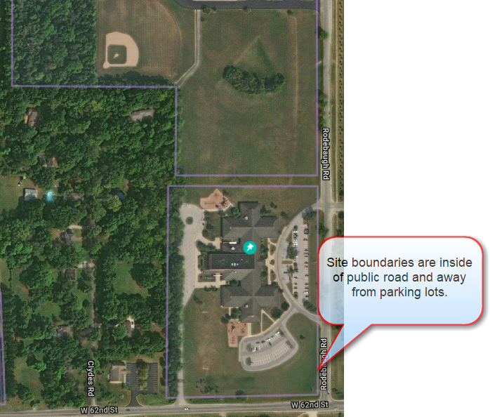
Some large Sites may have property that spans across streets that are navigable by the public. In such cases, you would need to:
-
Create a separate custom Place for each section of the property.
-
Draw separate Site polygons around each custom Place, without overlapping the public road.
-