Trimble CoPilot 11: The next generation of commercial vehicle navigation
Trimble CoPilot 11 is the next generation of Trimble’s mobile application for commercial vehicle navigation. With a modern look and new features, CoPilot 11 is designed to enhance a driver’s experience while providing the safe, legal, and reliable navigation professional drivers have come to expect from CoPilot.
CoPilot 11 is available for Android devices via Google Play.
CoPilot 11 has been completely redesigned not only from a user’s point of view but also to help fleets more quickly and easily deploy the app and keep road maps up to date.
Updates include:
A new ergonomic, user-friendly interface
CoPilot 11 offers a streamlined routing and mapping experience by leveraging Trimble’s new mobile maps and enhanced navigation.
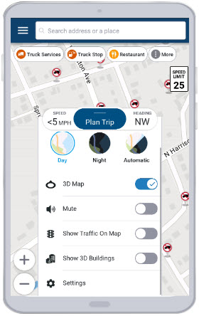
Multiple display options
With different displays for portrait or landscape mode, CoPilot 11 provides a better experience for drivers using the app on a tablet or a smartphone.
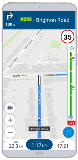
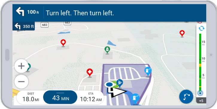
More information at a glance
Trip details, maps, and route data are all available on a single screen. This helps drivers spend less time interacting with or switching screens, which enhances safety.
More intuitive and accessible
Important controls and menus are within easy reach for the driver, while lighter and cleaner color schemes improve readability. CoPilot 11 also includes a Day/Night button that allows for quick and easy switching between day and night modes.
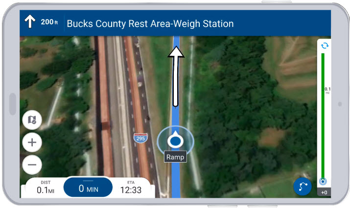
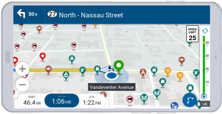
A "map-first" approach
CoPilot 11 is designed to be more map-centric, as the map is always on the screen. This approach makes it easier for drivers to understand their route and surroundings. Satellite map imagery provides drivers with more visual cues and improved location visibility when planning a trip.
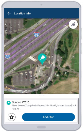
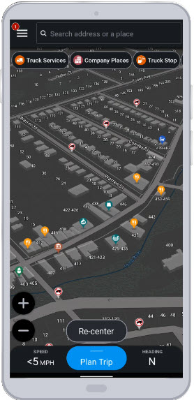
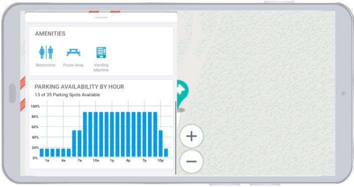
Predictive parking (North America only)
CoPilot 11 provides a driver with live parking insights before they arrive at a Place, such as a rest stop or truck stop. All of this information reduces driver stress with planning and improves efficiency.
Parking information is based on live and historical data at a location, as well as actual feedback from CoPilot drivers. When a driver arrives at a parking area, they receive a notification prompting them to share their feedback on the spot. They have three choices to describe the parking availability: Plenty, Limited, and None.
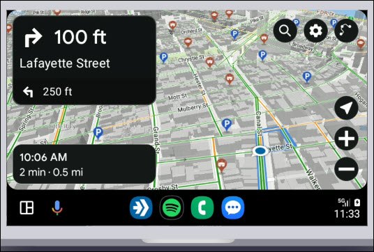
Android Auto
Drivers can connect their Android device with their vehicle infotainment system using Android Auto to enable a seamless navigation experience.
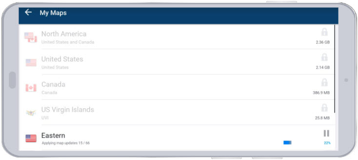
Smaller, faster map updates
Map data stored on the device can now be updated faster than ever. CoPilot 11 only downloads and installs the differences between the map data currently on device and the latest data available. (Previous versions of CoPilot replace the entirety of old map data with new map data.)
This change not only increases the speed of updates, but also reduces the size of downloads by 75 to 90 percent.
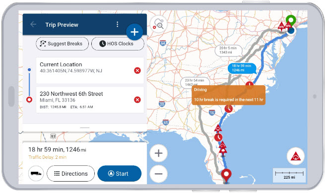
Hours of Service (HOS) planning (U.S. Only)
(Requires ELD integration with CoPilot and licensing for Trip Management)
CoPilot can now display Hours of Service (HOS) clocks to help drivers safely plan required rest stops and avoid HOS compliance violations. Drivers can also take advantage of a Suggest Breaks feature where CoPilot suggests rest stops at the points in trip where breaks are required.