NORTH AMERICA Rail Stations, FSAC, and Rail SPLC File with Latitude/Longitude Coordinates
This Geocode File includes a list data records for active rail freight stations in North America along with the corresponding rail-related identification codes that are accessible in PC*MILER Rail. It includes the same information as the North America Rail Stations, FSAC, and Rail SPLC File with the addition of latitude/longitude coordinates also listed per record. The file is sorted by Standard Carrier Accounting Code/Railroad Alpha Code (SCAC) and then Freight Station Accounting Code (FSAC).
PC*MILER RAIL LICENSE REQUIREMENT:
A base license of the corresponding version for at least one of the following PC*MILER Rail products, and an additional fee, are required in order to gain access to this Geocode File:
-
PC*MILER Rail
-
PC*MILER Rail Web Services (any Feature Level)
FILE EXCERPT:
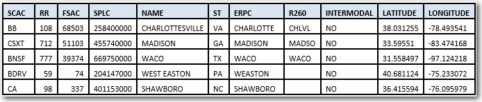
CATEGORY DEFINITIONS:
-
SCAC – Standard Carrier Accounting Code or Railroad Alpha Code
-
RR – Railroad Number Code assigned by AAR
-
FSAC – Freight Station Accounting Code
-
STATION NAME – as registered with the Centralized Station Master
-
ST – State/Province/Estado abbreviation
-
SPLC – Standard Point Location Code
-
ERPC – Eastern Railroad President’s Conference Code or 3-3-3
-
R260 – Rule 260 Junction Interchange Code (field is blank for stations that are not junctions)
-
INTERMODAL – Specifies if the station has intermodal service
FILE NAME:
-
PCMILER Rail XX_Geocode File_Stations File with LatLong.csv
NOTE: "XX" refers to the version number.
FILE NOTES:
-
See a list of railroads included in this file.
VERSION SPECIFIC FILE NOTES:
-
Not applicable