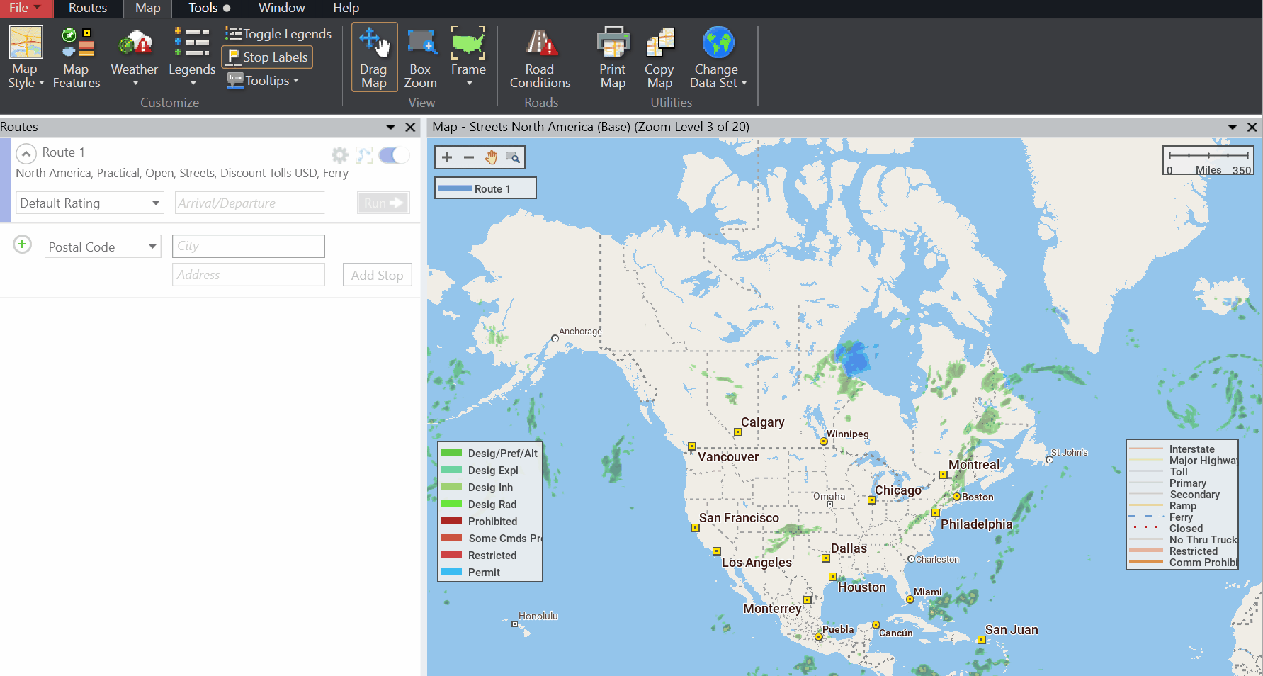
Map Legends
To hide or display individual legends on the map, select the Map tab > Legends. Each legend can be toggled on/off. In PC*Miler 36 and later, a Map tab > Toggle Legends button allows you to hide all legends in a single click. To view the legends on the map again, select Legends and check the boxes next to the legends you want to display.
A legend can be moved to any position on the map – click and drag it to the desired location.
Road Legend
Shows how PC*Miler road classes appear on the map. This legend is displayed by default. Road colors will depend on which map style is chosen.
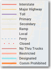
Road types included in each road class are:
| Interstate | Multi-lane toll free and urban highways |
|---|---|
Major Highway |
Major highways, urban access roads |
Toll |
Toll roads and urban highways |
Primary |
Non-divided highways |
Secondary |
Non-divided highways, urban access roads, ferries |
Ramp |
Exit and entrance ramps |
Local |
Truck-discouraged roads (as defined by PC*Miler) |
Ferry |
Ferries |
Closed |
Temporary road closure. |
No Thru Trucks |
Not compatible for trucks, as determined by PC*Miler |
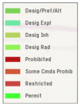
Restricted |
Most kinds of trucks prohibited, as determined by the controlling governmental authority. Appears if “Truck Restrictions” is checked in the Map Features dialog. |
Designated |
Designated 53' road network (these roads have either “State Oversized”, “Oversized Access”, or “National Network” designations on them). Appears if “Designated Truck Routes” is checked in Map Features. |
Comm Prohibited |
Roads that are prohibited for commercial truck traffic. Appears if “Commercially Prohibited” is checked in Map Features. |
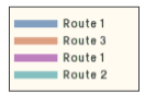
Route Legend
Appears if at least one route window is open; provides a key to the color(s) used to draw each generated route on the map. Routes are listed in the order they were generated.
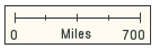
Scale of Miles
A standard component of most maps, providing the scale of miles/kilometers. Appears by default. To change from miles to kilometers, go to File menu > Application Settings > Units > Length and Distance in.
Hazmat Legend
If the Hazmat add-on data module is installed, a legend showing hazmat restrictions will be available.
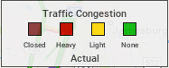
Traffic Legend
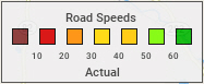
For Traffic add-on subscribers only, this legend shows the significance of the colors used for traffic flows on the map.
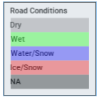
Road Conditions Legend
For Weather add-on subscribers, the legend shows the colors associated with current road conditions as well as road conditions up to 24 hours in advance. (Road conditions are informational only and are not used in route calculation.)