Highway Junctions (North America only)
PC*Miler allows you to add highway junctions between major road types in the United States, Canada, and Mexico as stops. (Note, however, there are some highway junctions that are truck-inaccessible. These junctions won’t be recognized as stops.)
The format for junction names is: the plus sign, the first route name, the second route name, and the route names are followed by the abbreviation of the state in which the junction is located.
Example: +I 469 IN 37, IN
In cases where two junctions by the same highway pair occur within the same state, the junctions are designated by a location direction (N, S, E, W) relative to the location of the other junction.
Example: +US231 IN 66W, IN is one mile west of +US231 IN 66E, IN
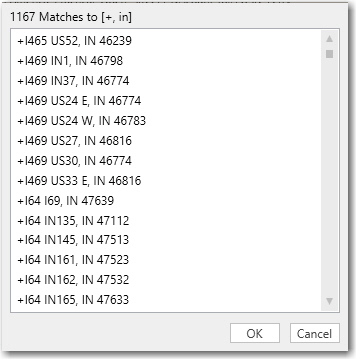
The best way to enter a highway junction is to invoke a pick list of matches. Type a plus sign (+) followed by a comma and the state abbreviation.
Example: For highway junctions in Indiana, enter: +, in